Computer vision is a technology that uses artificial intelligence and machine learning to interpret and understand visual data from cameras and other sensors. In the context of fleet management, computer vision can be used to improve the efficiency, safety, and performance of a fleet of vehicles.
Some of the applications of computer vision that can be used in fleet management include
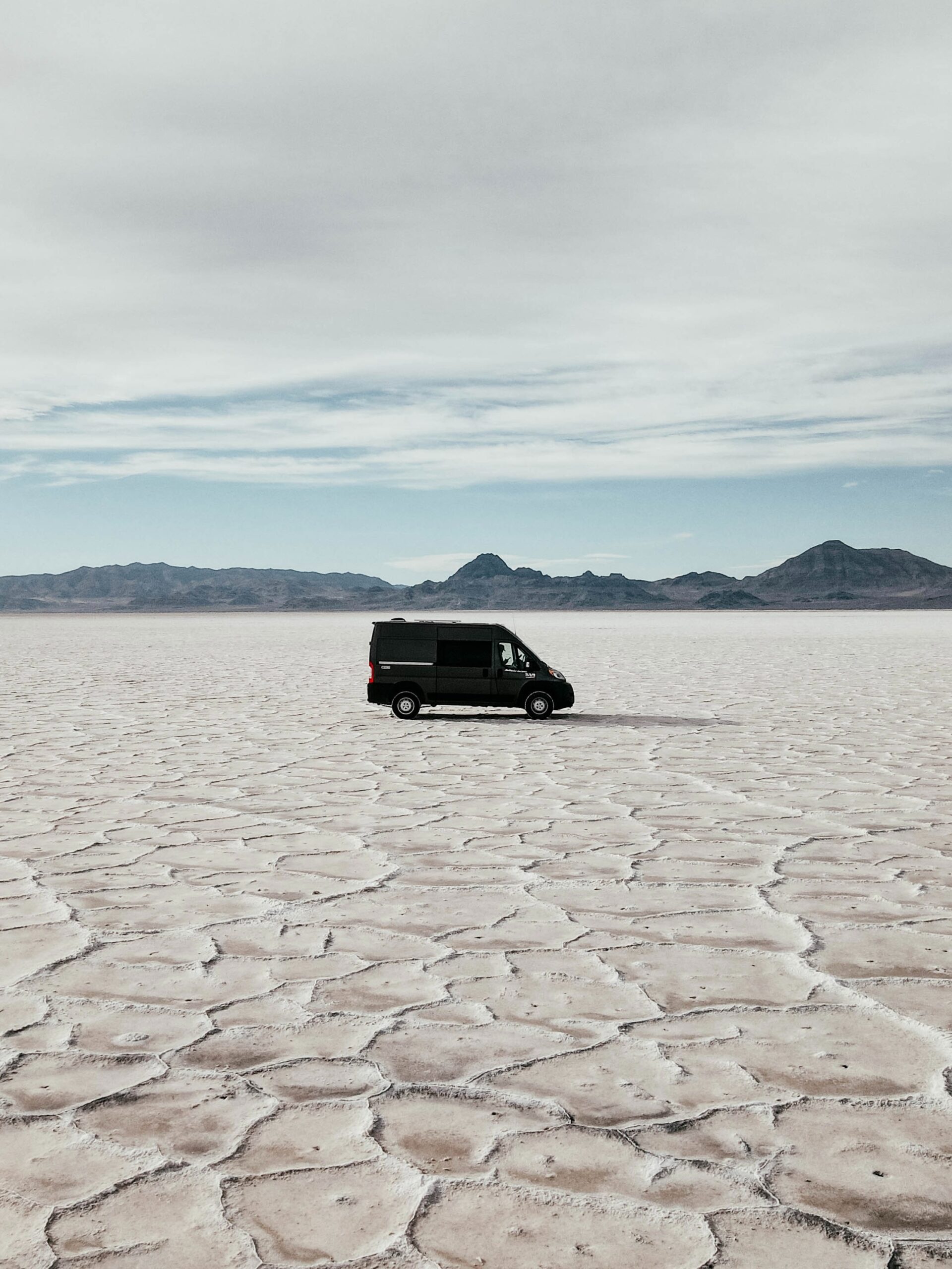
1. Vehicle tracking and monitoring
Vehicle tracking and monitoring is the use of computer vision technology to track the location and status of vehicles in a fleet. This can include real-time information such as the vehicle’s speed, fuel consumption, and engine performance. This information can be used by fleet managers to optimize routes, increase efficiency, and improve safety.
Computer vision-based vehicle tracking and monitoring can be achieved through the use of GPS, cameras, and other sensors installed on vehicles. This data can then be transmitted to a central system where it can be analyzed and used to make informed decisions about fleet management. For example, by monitoring the location of vehicles in real time, fleet managers can optimize routes to reduce travel time and fuel consumption.
By monitoring vehicle speed, they can also identify and address any instances of reckless or unsafe driving. Additionally, by tracking fuel consumption, they can identify and address any issues with fuel efficiency. In summary, vehicle tracking and monitoring allow fleet managers to have a real-time view of their fleet operations, enabling them to optimize routes, increase efficiency, and improve safety.
2. Driver behavior monitoring
Driver behavior monitoring is the object recognition software employed to monitor and analyze the actions of drivers in a fleet. This can include monitoring driver behavior such as seatbelt usage, distracted driving, and speeding. The goal is to identify and address any unsafe or reckless driving habits in order to improve the overall safety of the fleet. Computer vision-based driver behavior monitoring can be achieved through the use of cameras and other sensors installed in the vehicles.
These sensors can capture visual data of the driver and the vehicle’s surroundings. This data can then be analyzed by the computer vision system to identify specific behaviors such as seatbelt usage, distracted driving, and speeding. For example, by monitoring seatbelt usage, fleet managers can ensure that all drivers are complying with safety regulations and reduce the risk of injuries in the event of an accident. By monitoring distracted driving, such as the use of mobile phones while driving, they can reduce the risk of accidents caused by distracted drivers.
And by monitoring speeding, they can ensure that drivers are adhering to posted speed limits and reduce the risk of accidents caused by excessive speed. In summary, driver behavior monitoring is a way of using need to use machine learning and artificial intelligence to monitor and analyze the actions of drivers in a fleet, with the goal of identifying and addressing any unsafe or reckless driving habits in order to improve the overall safety of the fleet.
3. Predictive maintenance
Predictive maintenance is a proactive maintenance strategy and hence leverages robotic systems and other technologies to predict when equipment or machinery is likely to fail. This allows maintenance to be scheduled in advance, reducing downtime and increasing efficiency. Computer vision-based predictive maintenance can be achieved through the use of cameras, sensors, and other devices installed on equipment or machinery.
These devices capture data such as temperature, vibration, and other metrics which are analyzed by the computer vision system. The system can then predict when equipment is likely to fail by identifying patterns and anomalies in the data. For example, by monitoring the vibration of a vehicle’s engine, the computer vision system can predict when the engine is likely to fail, allowing for maintenance to be scheduled in advance before the failure occurs.
Similarly, by monitoring the temperature of equipment, the system can predict when a component is likely to overheat, allowing for maintenance to be scheduled in advance, and avoiding unexpected breakdowns. In summary, predictive maintenance is the employment of technologies such as face recognition to predict when equipment or machinery is likely to fail, allowing maintenance to be scheduled in advance, reducing downtime, and increasing efficiency.
4. Automatic number plate recognition
Automatic Number Plate Recognition (ANPR) is a technology it includes object tracking to automatically identify and read the license plates of vehicles. It is typically used for traffic enforcement, security, and toll collection. ANPR systems work by capturing an image of a vehicle’s license plate using cameras or other image-capturing devices. The image is then processed by a computer vision algorithm that can recognize and read the characters on the license plate.
The recognized characters are then compared to a database of license plate numbers to identify the vehicle and its registered owner. For example, ANPR can be used by law enforcement to identify and track stolen vehicles, or to enforce traffic laws such as detecting vehicles with expired registration or outstanding traffic fines. ANPR can also be used for security and access control, such as in parking garages or gated communities.
And in the case of toll collection, ANPR can be used to automatically charge tolls to vehicles passing through toll booths without stopping. In summary, Automatic Number Plate Recognition (ANPR) is a technology that uses computer vision to automatically identify and read the license plates of vehicles, it’s widely used in traffic enforcement, security, and toll collection.
5. Obstacle detection
Obstacle detection is the video processing tech efficiency to detect and identify obstacles in the path of a vehicle or machine. This can include obstacles such as other vehicles, pedestrians, animals, and stationary objects such as buildings and barriers. Obstacle detection systems typically use cameras or other sensors to capture visual data of the vehicle’s surroundings.
This data is then analyzed by a computer vision algorithm to detect and identify obstacles. Once an obstacle is detected, the system can take appropriate action, such as alerting the driver or automatically braking the vehicle. For example, in the case of a self-driving car, an obstacle detection system would be used to detect and avoid other vehicles, pedestrians, and other obstacles on the road.
In construction or mining equipment, obstacle detection can be used to detect and avoid workers, other vehicles, and other equipment on the job site in the final result, obstacle detection is the use of computer vision technology to detect and identify obstacles in the path of a vehicle or machine, it helps to increase safety and prevent accidents.
6. Lane departure warning
Lane departure warning ( LDW) is an innovation that just integrates lidar to detect when a vehicle is deviating from its lane on the road. It is designed to help prevent accidents caused by drivers drifting out of their lane, such as those caused by driver fatigue, distraction, or impairment. LDW systems typically use cameras or other sensors to capture visual data of the vehicle’s surroundings. This data is analyzed by a computer vision algorithm to detect the lane markings on the road.
The system can then determine the vehicle’s position relative to the lane markings and determine if the vehicle is drifting out of its lane. If the vehicle is determined to be deviating from its lane, the system will alert the driver, usually with a visual or audible warning. For example, in a car, the LDW system would use cameras to detect the lane markings on the road and alert the driver if the vehicle begins to drift out of its lane.
In some cases, the system may also be able to automatically steer the vehicle back into its lane. In summary, Lane Departure Warning (LDW) is a technology that integrates inertial sensors to detect when a vehicle is deviating from its lane on the road, it’s designed to help prevent accidents caused by drivers drifting out of their lane by alerting the driver, usually with a visual or audible warning.
7. Traffic sign recognition
Traffic sign recognition(TSR) gadgets that direct edge detection to automatically recognize and respond to traffic signs such as speed limits, stop signs, and yield signs. It is designed to help improve driver safety and compliance with traffic laws. TSR systems typically use cameras or other sensors to capture visual data of the vehicle’s surroundings. This data is then analyzed by a computer vision algorithm to detect and recognize traffic signs.
The system can then take appropriate action based on the traffic sign that is recognized. This can include alerting the driver, adjusting the vehicle’s speed, or automatically braking the vehicle. For example, in a car, the TSR system would use cameras to detect and recognize traffic signs such as speed limits and stop signs. The system would then alert the driver if they are exceeding the speed limit, and automatically slow down the vehicle if they are approaching a stop sign.
In highlight, Traffic Sign Recognition (TSR) is the operation of object recognition hardware to automatically recognize and respond to traffic signs such as speed limits, stop signs, and yield signs. It helps improve driver safety and compliance with traffic laws by alerting the driver, adjusting the vehicle’s speed, or automatically braking the vehicle.
8. Intelligent cruise control
(ICC) is a technology that characterizes image processing algorithms and other sensors to automatically adjust the speed of a vehicle based on the traffic conditions around it. It is designed to improve driver comfort, reduce fuel consumption and increase safety. ICC systems typically use cameras or radar sensors to detect the distance and speed of other vehicles on the road. This data is then analyzed by a computer vision algorithm to determine the appropriate speed for the vehicle.
The system can then automatically adjust the vehicle’s speed to maintain a safe distance from other vehicles, and also match the speed of traffic flow. This allows the vehicle to maintain a consistent speed without the need for the driver to constantly adjust the accelerator. Additionally, in some systems, the ICC can also come to a full stop if the traffic ahead stops, and resume the journey automatically once the traffic starts moving again. For example, in a car, the ICC system would use cameras to detect the distance and speed of other vehicles on the road and adjust the vehicle’s speed accordingly to maintain a safe distance and match the speed of traffic flow.
To outline, Intelligent Cruise Control (ICC)is a field in which computer detection and tracking. and other sensors to automatically adjust the speed of a vehicle based on the traffic conditions around it. It improves driver comfort, reduces fuel consumption, and increases safety by maintaining a safe distance from other vehicles and matching the speed of traffic flow.
9. Automatic parking assistance
Automatic Parking assistance (APK) is a technology that employs feature extraction and other sensors to assist drivers in parking their vehicles. It is designed to improve driver convenience and reduce the risk of accidents while parking. APA systems typically use cameras and sensors to capture visual data of the vehicle’s surroundings while the driver is attempting to park. This data is then analyzed by a computer vision algorithm to determine the appropriate path for the vehicle to take to safely park.
The system can then provide guidance to the driver, such as through visual or audible prompts, to guide the vehicle into a parking spot. Some systems can also automatically control the vehicle’s steering, braking, and acceleration to park the vehicle without driver input. For example, in a car, the APA system would use cameras and sensors to detect the location of parking spaces and provide guidance to the driver to help them park the vehicle safely and efficiently.
In summary, Automatic Parking Assistance (APA) is a set of computer scanners. and other sensors to assist drivers in parking their vehicles. It improves driver convenience and reduces the risk of accidents while parking by providing guidance and in some cases, automatically controlling the vehicle’s steering, braking, and acceleration.
10. Collision avoidance
Collision avoidance is a technology going to utilizes automation and other sensors to detect and prevent collisions with other vehicles, pedestrians, and other obstacles. It is designed to improve vehicle safety and reduce the risk of accidents. Collision avoidance systems typically use cameras, radar, and other sensors to capture visual and other data of the vehicle’s surroundings. This data is then analyzed by a computer vision algorithm to detect and identify potential collision hazards.
Once a potential collision is detected, the system can take appropriate action, such as alerting the driver, applying the brakes, or steering the vehicle to avoid the collision. For example, in a car, the collision avoidance system would use cameras and radar to detect the presence of other vehicles, pedestrians, and other obstacles on the road. If a potential collision is detected, the system would alert the driver and may automatically brake the vehicle or steer it to avoid the collision. Some systems can also include automatic emergency braking (AEB) which will automatically apply brakes if the driver doesn’t respond to the warning in a timely manner.
In summary, Collision avoidance is the efficiency of deep-learning software and other sensors to detect and prevent collisions with other vehicles, pedestrians, and other obstacles. It improves vehicle safety and reduces the risk of accidents by alerting the driver, applying the brakes, or steering the vehicle to avoid collisions.
11. Intelligent traffic management
Intelligent traffic management( ITM) is the exploitation of vision-based software and other sensors to analyze traffic patterns and optimize routes for vehicles in a fleet. It is designed to improve traffic flow, reduce travel time and fuel consumption, and increase the overall efficiency of the fleet. ITM systems typically use cameras and other sensors to capture visual data of the traffic on the roads. This data is then analyzed by a computer vision algorithm to determine traffic patterns, such as the location of congestion, accident hotspots, and other factors that can affect travel time.
The system can then use this information to optimize routes for vehicles in the fleet, helping to reduce travel time and fuel consumption. For example, in a fleet of delivery trucks, the ITM system would use cameras to detect traffic congestion and accidents on the roads and adjust the routes of the trucks in real-time to avoid those areas and minimize delays. It can also optimize the routes of the fleet to reduce time and fuel consumption. In summary, Intelligent Traffic Management (ITM) is a technology implementing image processing techniques and other sensors to analyze traffic patterns and optimize routes for vehicles in a fleet. It improves traffic flow, reduces travel time, and increases the overall efficiency of the fleet by using real-time traffic data to optimize routes and reduce delays.
12. Vehicle identification
Vehicle Identification is the process of by means of cell graphics to identify and track specific vehicles in a fleet. It is used to improve the management and efficiency of a fleet of vehicles by providing real-time information about the location, status, and performance of each vehicle. Vehicle identification systems typically use cameras and other sensors to capture visual data of the vehicles in the fleet. This data is then analyzed by a computer vision algorithm to identify specific vehicles based on characteristics such as their make, model, color, and license plate number.
Once a vehicle is identified, the system can then provide real-time information about the vehicle’s location, status, and performance. For example, the system can track the location of each vehicle in real-time, monitor fuel consumption and engine performance, and detect and predict potential maintenance issues. In summary, Vehicle identification is the process by means of a digital vision to identify and track specific vehicles in a fleet. It improves the management and efficiency of a fleet of vehicles by providing real-time information about the location, status, and performance of each vehicle.
13. Cargo management
Cargo management is the gathering activity, tracking, and optimizing the transportation and storage of goods and materials. It involves the use of various tools and technologies, such as computer vision, to improve the efficiency, security, and accuracy of cargo operations. Computer vision-based cargo management systems can use cameras and other sensors to capture images and data of cargo as it’s being loaded, transported, and stored.
This data can then be analyzed by a computer vision algorithm to identify and track specific items, monitor cargo conditions, and detect any irregularities such as damages. For example, in a warehouse, a cargo management system can use computer vision to automatically identify and track specific items as they are loaded and unloaded from trucks, and monitor the condition of the cargo to ensure it’s not damaged during transport. In a shipping container terminal, You can employ ai. to detect and track the containers, and monitor the cargo inside the containers to ensure it’s safe and secure.
In summary, Cargo management is the process of organizing, tracking, and optimizing the transportation and storage of goods and materials, which can be improved by using computer vision to identify, track, monitor, and detect any irregularities in the cargo.
14. Fuel management
Fuel management is the technique of surveillance, measuring, and optimizing the use of fuel by a fleet of vehicles or equipment. It involves the use of various tools and technologies, such as computer vision, to improve fuel efficiency and reduce fuel costs. Computer vision-based fuel management systems can use cameras and other sensors to capture images and data of vehicles and equipment.
This data can then be analyzed by a computer vision algorithm to identify and track specific vehicles and equipment, monitor fuel consumption, and detect any irregularities such as fuel theft or unauthorized use. For example, in a fleet of vehicles, a fuel management system can use computer vision to track the location and usage of each vehicle, monitor fuel consumption in real time, and detect any instances of fuel theft or unauthorized use. In a construction site, computer vision can be used to monitor the fuel consumption of heavy equipment, and identify any equipment that is consuming more fuel than usual, indicating a potential maintenance issue.
In summary, Fuel management is the process of monitoring, measuring, and optimizing the use of fuel by a fleet of vehicles or equipment. It can be improved in a video processing setting to identify, track, monitor, and detect any irregularities such as fuel theft, unauthorized use, and potential maintenance issues.
15. Remote diagnostics
Remote diagnostics is the innovation that should be used, especially pattern recognition, to remotely monitor and diagnose the performance and condition of vehicles, equipment, or other machines. It is designed to improve the efficiency, effectiveness, and safety of maintenance and repair operations. Computer vision-based remote diagnostics systems can use cameras and other sensors to capture images and data of vehicles, equipment, or other machines.
This data can then be analyzed by a computer vision algorithm to identify and diagnose potential issues such as wear and tear, component failure, or other performance problems.
For example, in a fleet of vehicles, a remote diagnostics system can use computer vision to monitor the condition of the engines, tires, and other components in real-time, and alert the fleet manager of any potential issues that need to be addressed. In a manufacturing facility, computer vision can be used to monitor the condition of machines and equipment, and alert maintenance staff of any potential issues before they cause downtime or production losses.
In summary, Remote diagnostics is the use of technology, such as using image processing techniques to remotely monitor and diagnose the performance and condition of vehicles, equipment, or other machines. It improves the efficiency, effectiveness, and safety of maintenance and repair operations by identifying and diagnosing potential issues in real time.
16. Automatic toll payment
Automatic toll payment is a policy that makes connections between different tools, such as image retrieval to automatically detect and charge tolls for vehicles passing through toll booths or toll roads. It is designed to improve the efficiency and convenience of toll collection and reduce the need for drivers to stop and pay tolls manually. Computer vision-based automatic toll payment systems typically use cameras or other image-capturing devices to capture images of vehicles as they pass through toll booths or toll roads.
The images are then analyzed by a computer vision algorithm to detect the vehicle’s license plate number, and the system then matches the license plate number to a pre-registered account or credit card. The toll fee is automatically charged to the account or credit card linked to the license plate number, eliminating the need for the driver to stop and pay manually. For example, in a toll road, the automatic toll payment system would use cameras to capture images of vehicles as they pass through the toll booths, and automatically charge the toll fee to the account or credit card linked to the vehicle’s license plate number.
To summarize, Automatic toll payment is a system harnessing TensorFlow and other technologies to automatically detect and charge tolls for vehicles passing through toll booths or toll roads, it improves the efficiency and convenience of toll collection by eliminating the need for drivers to stop and pay tolls manually.
17. Surveillance
Surveillance is the practice of monitoring and observing people, places, or things employing a variety of techniques such as cameras, sensors, and computer vision. It is used for a variety of purposes, including security, safety, and crime prevention. Computer vision-based surveillance systems use cameras or other image-capturing devices to capture images of the area being monitored. These images are then analyzed by computer vision algorithms to detect, identify, and track people, vehicles, or other objects of interest. The system can then provide real-time information and alerts to security personnel, such as the location of potential security breaches, the presence of suspicious individuals or vehicles, or other potential threats.
Additionally, the captured images can be stored for later analysis or used as evidence in legal proceedings. For example, in a shopping mall, surveillance cameras would be used to monitor the public areas for any suspicious activities or individuals, and security personnel would be alerted if anything out of the ordinary is detected. In a city, surveillance cameras would be used to monitor the streets and detect any criminal activities or traffic violations.
In summary, Surveillance is the practice of monitoring and observing people, places, or things using various technologies such as cameras, sensors, and synthetic awareness. It’s used for a variety of purposes, including security, safety, and crime prevention by providing real-time information and alerts to security personnel, and can be stored for later analysis or used as evidence in legal proceedings.
18. Weather Monitoring
Weather monitoring is the procedure of measuring, analyzing, and forecasting various weather parameters such as temperature, humidity, wind speed, precipitation, and atmospheric pressure. It involves the use of various tools and technologies, such as computer vision, to improve the accuracy, timeliness, and accessibility of weather information. Computer vision-based weather monitoring systems can use cameras and other sensors to capture images and data of weather conditions, such as clouds and precipitation.
These images and data can then be analyzed by computer vision algorithms to detect and identify various weather patterns and phenomena, such as cloud types, precipitation, and atmospheric conditions. For example, in a weather station, a computer vision-based system can be used to analyze images of clouds and precipitation captured by cameras to detect and identify the types of clouds, estimate the precipitation rate and classify the weather patterns. In weather radar, computer vision can be used to process the radar data and create detailed images of storm systems, helping to detect and predict severe weather conditions.
To sum it all up, Weather monitoring is the process of measuring, analyzing, and forecasting various weather parameters such as temperature, humidity, wind speed, precipitation, and atmospheric pressure, it can be improved by using computer vision to detect, identify, and classify various weather patterns and phenomena.
19. Route optimization
Route optimization is the approach of determining the most efficient and cost-effective way to travel from one location to another. It involves the use of various tools and technologies, such as computer vision, to analyze traffic patterns and road conditions, and to plan routes that minimize travel time and distance while avoiding congestion, accidents, and other potential delays. Computer vision-based route optimization systems can use cameras and other sensors to capture images and data on the roads and traffic conditions. This data is then analyzed by computer vision algorithms to determine the location of congestion, accidents, and other potential delays.
The system can then use this information to plan routes that minimize travel time and distance while avoiding these potential delays. For example, in a fleet of delivery trucks, a route optimization system would use cameras to detect traffic congestion and accidents on the roads and adjust the routes of the trucks in real-time to avoid those areas and minimize delays.
In a navigation system for a car, computer vision can be used to detect and recognize traffic signs, and adjust the route accordingly to avoid traffic congestion and improve the trip time. In summary, Route optimization is the process of determining the most efficient and cost-effective way to travel from one location to another by using various tools and technologies, such as robotic intelligence, to analyze traffic patterns and road conditions, and plan routes that minimize travel time and distance while avoiding congestion, accidents, and other potential delays.
20. Accident reconstruction
Accident reconstruction just uses a wide range of techniques and capabilities, such as medical image processing, to gather and analyze data to determine the cause and circumstances of a traffic accident. This information is used to identify any factors that contributed to the accident, and to evaluate how the accident could have been prevented. Computer vision-based accident reconstruction systems can use cameras and other sensors to capture images and data of the accident scene and vehicles involved. This data is then analyzed by computer vision algorithms to determine the position and movement of the vehicles, the speed at which they were traveling, and the conditions of the road at the time of the accident. This information can be used to create a detailed reconstruction of the accident, including the point of impact, the trajectory of the vehicles, and any other relevant details.
For example, in a traffic accident involving multiple vehicles, a computer vision-based accident reconstruction system would use cameras to capture images of the accident scene, including the positions of the vehicles, the skid marks, and other relevant details. The system would then use computer vision algorithms to analyze this data and create a detailed reconstruction of the accident, including the point of impact, the trajectory of the vehicles, and any other relevant details.
In summary, Accident reconstruction is the process of using various tools and technologies, including fundamentals of video processing, to gather and analyze data to determine the cause and circumstances of a traffic accident. This information is used to identify any factors that contributed to the accident, and to evaluate how the accident could have been prevented by analyzing the position and movement of the vehicles, the speed at which they were traveling, and the conditions of the road at the time of the accident.